
Phone/Tablet Applications

Listed below are applications that may be used to assist you and your family in the event of an emergency. Many of these "apps" are available on numerous platforms such as "Windows Phone", "Android System", or "Apple". Most of those listed below are free for download, but there are a few that require a nominal fee.
The logo will take you to the download site.

The American Red Cross has developed various applications for everyday occurrences, natural disasters, and medical emergencies. These "apps" are also available for download in Spanish.

The Federal Emergency Management Agency's mobile app for phones and tablets contains disaster safety tips, an interactive emergency kit list, storable emergency meeting locations, and a map with open shelters and open FEMA Disaster Recovery Centers (DRCs).

Waze is an interactive community-based mapping system. Users can make notes, determine roads that are impassable, and help locate where Police may be stationed after a major incident.

Twitter is a Social Media platform that enables users to follow people, businesses, or agencies. Even if you are not "tech-savvy", it is well worth it to download and follow your local Police Department, Emergency Management Agency, Fire Department or municipality so that you stay up to date on critical happenings in the township.

Provides up to date and breaking news across the country and world.

Provides live camera feeds of commercial roadways in and around the South East Pennsylvania region.
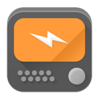
Provides radio scanner information for many areas across the world. Search for Montgoemry County, and make them your favorites!! Links for Apple, Android and Windows.